Six Mile Creek

Posted on July 13, 2014

Six Mile Creek from Palmo Cove

Entrance to Six Mile Creek from Palmo Cove

It seemed like we paddled for six miles before reaching the SR-13 overpass and what I consider the start of the creek. A decision to put in at the Palmo Cove boat ramp was probably not that wise, since it is 1.7 miles to the Crab Shack, through mainly open water. A decision not to use the Crab Shack access will be reconsidered next time. The only place to launch a boat there is not really designed for canoes or kayaks.

Reflected Union

Reflected Union – Six Mile Creek

SixMileCreek-2014-0713-067

Tunnel Reflection – Six Mile Creek

By the time we passed the bridge the sun was up and bright with not a cloud in the sky. I would guess we made it another 2 miles before we were turned around by a log. The creek itself was shady once the width narrowed and the trees arched over. I can see some beautiful photographs in different lighting conditions. When the light is poor we call refer to the trip as “reconnaissance.” Some people say there is no poor light, but for what I am looking for I need cloudy days.

Light Dance

Light Dance – Six Mile Creek

Even with the high contrast and highlights I was happy with the images. Sometimes you have to deal with what is there, and this was a wondrous place. I think we saw 2 docks. We’ll be back.

Simpson Creek

Posted on June 29, 2014

Simpson Creek-2014-0629-001

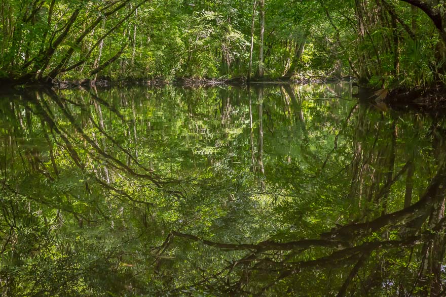
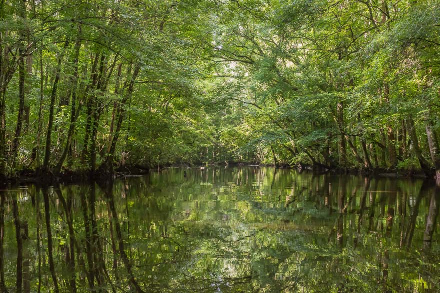
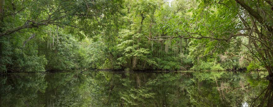
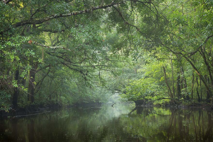
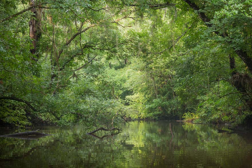
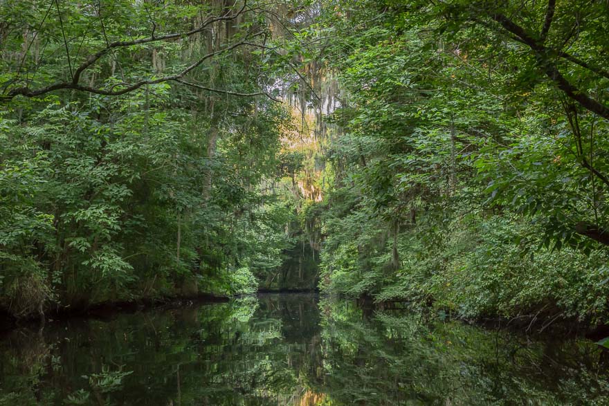
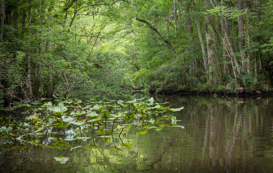
We’re going where? On Ft George River in search of Simpson Creek

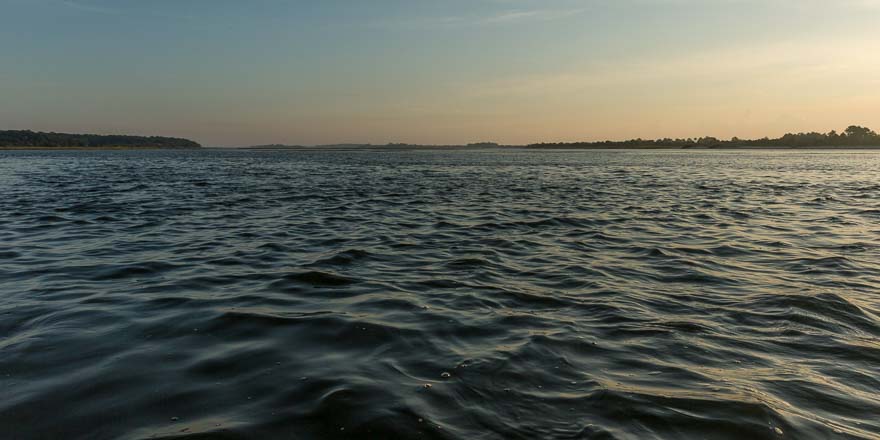
I can honestly say this was our most difficult trip.  I think we were nervous anyway because this was our first saltwater trip and we would not have our calm, peaceful, tree-covered creek. Salt marshes cover a majority of the wetlands around the mouth of the St Johns so we needed to explore. Our put in was at the Ft George Inlet boat ramp on Hecksher Drive, right before you cross over to Big Talbot Island (going north). It is 1.5 miles to the mouth of Simpson Creek over what seemed like the Atlantic Ocean, complete with sand bars and flowing water (against us). The tides are a big deal here, and we paddled hard. The sun was up and there were no clouds to protect us, no trees to shade us, no breeze except for the head wind. If I had any sense I would have turned around. Gray seemed to be having a good time, so when the trip quickly turns out to be a photo bust, you turn it into a workout session.

Simpson Creek-2014-0629-005

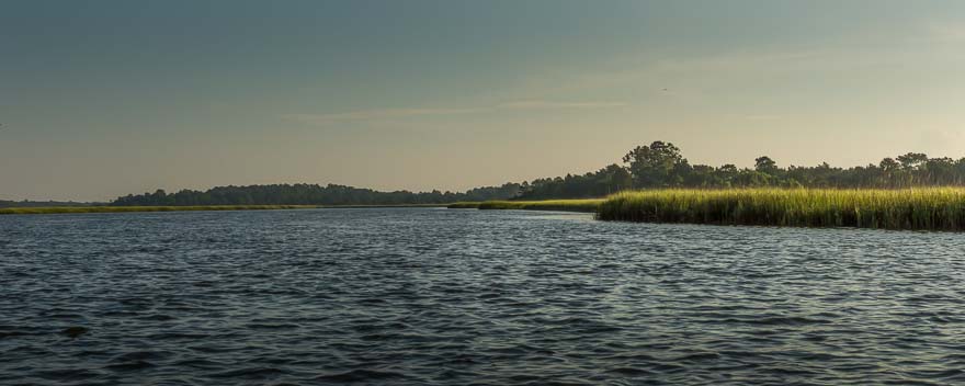
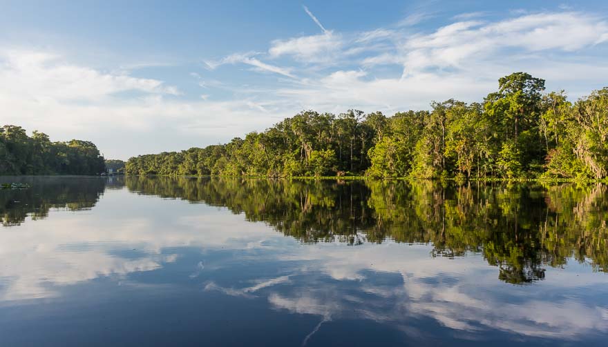
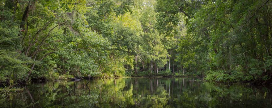
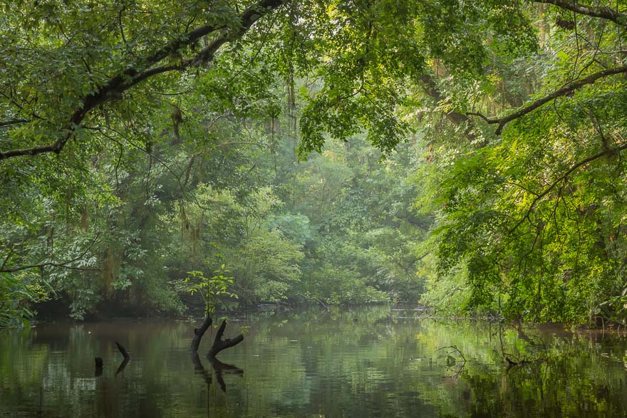
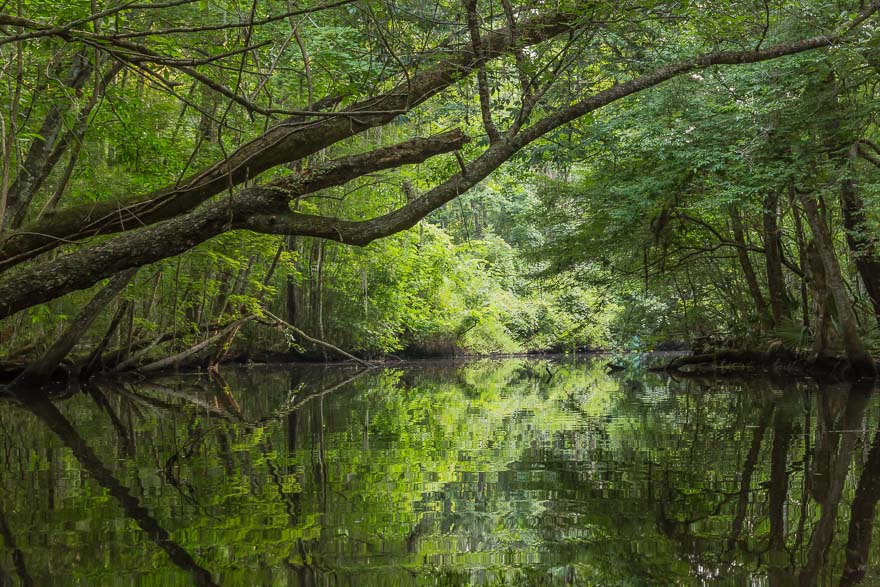
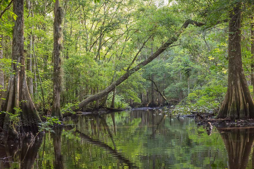
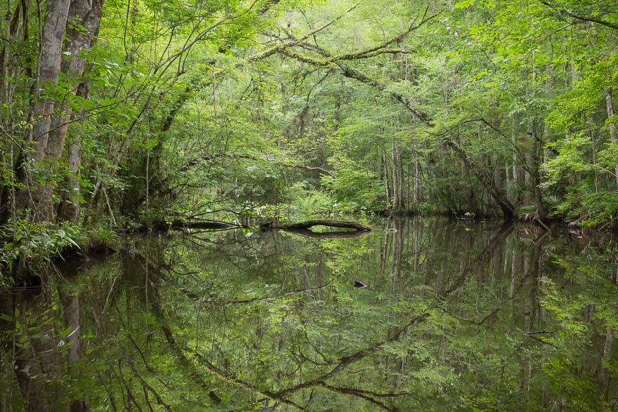
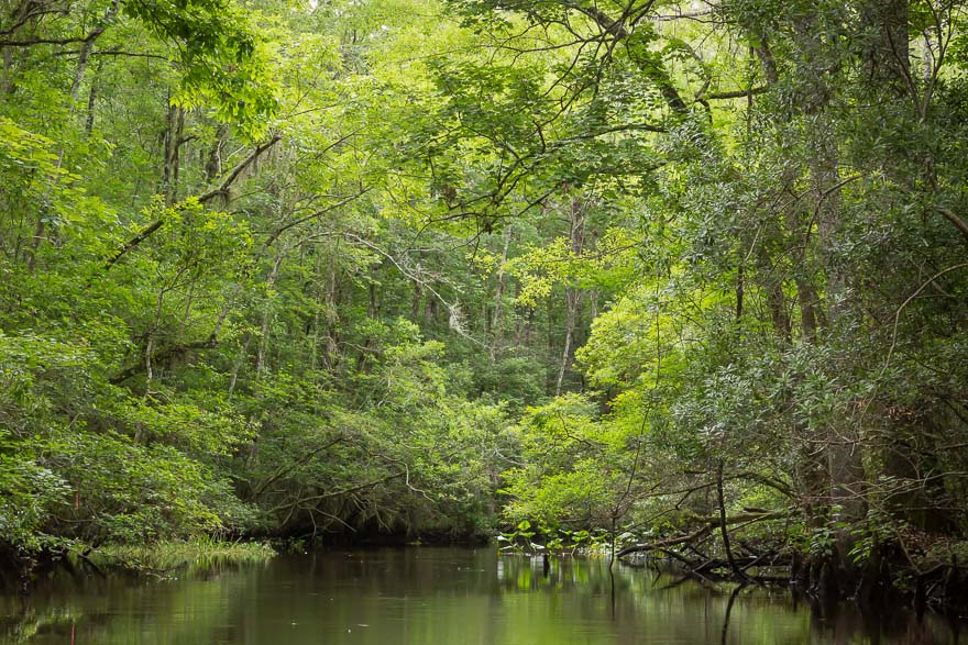
Mouth of Simpson Creek

Originally we were going to put in at Kayak Amelia, which would have put us in the middle of the creek where we wanted to be. For some insane reason we chose not to do that. Just too easy. We reached Kayak Amelia after 3.5 miles of tough paddling and we continued another half mile to the A1A bridge. After a long rest in the shade our alternative was to turn back, or leave our boats and hitchhike. It had taken us about 3 hours to get here, the return trip we knew, would be harder since the tides were coming in. Of course the temperature was in the 90s.

I really don’t enjoy paddling my boat for the sake of paddling. There’s no inner joy or zen release to move my paddle through the water, or to know that your destination is 3+ hours away and there is nothing you can do to make it shorter. Sometimes you play games like playing you’re on Hawaii-Five-O and one of the guys paddling that dugout canoe racing through the water. Other times you try to keep each stroke perfect so that you might just shave a half second off your time. Or you hope for that tailwind to push you along. Then a speedboat comes by, waves, and creates a wake that jostles your balance and spins you around. Curse you! But I’m having fun, enjoying the Florida sun, getting a great tan, and an awesome shoulder workout. Gray stated yelling at his boat about it going in the wrong direction when he stops paddling. Huh? I think he was losing it.

When we exited the creek and headed towards the bridge we had a new focal point. The only problem was that after 30 minutes the focal point seemed to be in exactly the same place. Was it possible that the combination of wind, tide, and exhaustion actually kept us in a stationary position? A few paddlers were going in the opposite direction, happy as clams, drinking beer, and doing very little paddling. Hmmm, they were riding the tide. Smart. I wonder what they thought of us, obviously struggling. Fellow kayakers can always tell when things aren’t going right, it’s the secret kayak intuition. “Hi, beautiful day to be on the water!” “Catch any fish?” “No, we’re photographers.” “That explains why you’re a moron trying to paddle against the tide at noon!” “Enjoy your day!”

When we returned the first thing I told Gray was to cross this trip off our list. “Done!”

Deep Creek 2

Posted on June 28, 2014

Deep Creek-2014-0628-152

Summer Morning – Deep Creek West

My second visit, this time paddling west towards the St Johns River. I knew the light was not going to be with us. Bright sunny mornings are the norm in Florida. The clouds usually roll in after noon and build into thunderstorms. Good light but being in a boat in a lightening storm is not something I want to do. Going west the creek gently widens. Deep Creek is part of the Deep Creek Conservation Area, a watershed set aside by the government to protect the wetlands and actually help the farmers deal with temperature fluctuations and flooding.

At one point there is a small island that splits the creek. I attempted two handheld panoramic shots that ended up being the keepers for the trip. This is another place to return under better conditions.

Split - Deep Creek West

Split – Deep Creek West

Deep Creek

Posted on June 22, 2014

Deep Creek_2014-0622-037

After the Rain – Deep Creek East

My first visit to Deep Creek. A full hours drive from the house. Nice launch area with plenty of parking on the side of SR-207 near Hastings. I paddled upstream and hoped for the best. Immediately I was immersed in a special world. Last night’s rain left the trees with plenty of moisture and there was a mist still lingering on top of the water. Not a soul in sight. I asked myself what is a “perfect” creek excursion? I think this was close.

Altar of Light - Deep Creek East

Altar of Light – Deep Creek East

As the sun rose I could see some shafts of light coming through the moist air. A particularly strong shaft of light caught my eye and I turned around to make another approach to make a photograph. That’s when I noticed the light’s reflection meeting at the surface of the water. This was new for me. After a few exposures (well more than a few) I resigned myself to having witnessed a special moment of discovery. Being on the creek brings the element of reflection to the composition. I knew this, but am continually surprised on how reflections appear. Sometimes the water is still, sometimes there’s a light ripple, and sometimes a fish jumps and leaves concentric circles. All of these surface conditions change the quality of the reflection.

Forest Renewal - Deep Creek East

Forest Renewal – Deep Creek East

I was disappointed to be turned around after about an hour. The tide was not high, so progress is dictated by the deadwood. The tree looked relatively fresh and perhaps I’ll return with my hand saw to try to make it further in. As the sun rises, the mist burns off, and the creek transforms into yet another view.

Turnaround Tree - Deep Creek East

Turnaround Tree – Deep Creek East

McCullough Creek

Posted on June 21, 2014

McCullough Creek_2014-0621-023

Early Summer – McCullough Creek

I’ve had my eye on McCullough Creek for a long time. In February of 2012 I drove down SR-13 and stopped at every bridge crossing a creek to photograph. I knew something special was contained within each waterway and felt so limited in my ability to go deeper and explore. Today I’m solo and transported my boat on top of my car. A little more effort than using the trailer but it all worked out. The McCullough put in is not very big, just a way to drive in and some room to park on the side. Someone arrived as I was unloading who had his fishing boat and a cooler of beer ready to go. We had a nice chat.

McCullough Creek in the Spring

McCullough Creek from SR-13 in the Spring of 2012

The creek is narrow and the sun rose quickly. I passed one dock and then a mass of Moonflowers. These are a type of Morning Glory and I think they are invasive but I couldn’t confirm that. This one was in the shade and hadn’t closed up. There is the occasional flower on the creeks that adds the spot of color to an otherwise totally green landscape.

Moonflower - McCullough Creek

Moonflower – McCullough Creek

Overhanging Trees - McCullough Creek

Overhanging Trees – McCullough Creek

After about 45 minutes some very thick deadwood blocked the path. Wow, that was quick. I brought my hand saw, but it looked like too much to try to hack through. By now the sun was getting over the trees and the light began to change. I decided to head back slowly, and then to go under the bridge to the St. Johns River. After passing under the overpass I spotted my fishing buddy and he was having a good day. The river was very close and I ventured out, soon turning back due to the waves and current. It was a beautiful morning but not the type of light for my photography.

Back to the car I loaded up and proceeded to Deep Creek to check out the launch point. That adventure would be tomorrow.

Durbin Creek 2

Posted on June 15, 2014

Launch Point View - Durbin Creek

Launch Point View – Durbin Creek

I love Durbin Creek. In addition to being close to my home, the creek represents my idea of an “ideal” Florida creek – twisty and overgrown with vegetation, a wild place where you could surprise a gator sunning on a log or a big blue heron fishing for dinner. The creek is long but unfortunately water hyacinths have clogged passage at several locations. You can only go less than a mile from the launch on Race Track Road. We can thank the good folks of the Clean Waterway Society for their efforts in establishing and maintaining the small park and keeping the creek clear. The water hyacinths have proved too much of a challenge to clear and we will have to wait for an industrial solution.

The light levels were very low at the beginning of the paddle. The creek was calm but the yellow flies very active. I hate those things! The water level was very low so we didn’t make it very far. There are several large fallen trees that must be crossed when the levels are high, so we did not even make it to the water hyacinth clog.

Durbin Reflection

Durbin Reflection – Durbin Creek

As the sun rose the forest began to glow.

Cypress on Durbin Creek - Durbin Creek

Cypress on Durbin Creek – Durbin Creek

There is a lot of residential development going one in the area. Everyday acres of land are being cleared for new tract houses. The creeks are being continually threatened by encroaching development. I don’t expect this to stop until every last inch of desirable property is consumed.

Thomas Creek 2

Posted on June 14, 2014

Thomas Creek

Heading West on Thomas Creek

Thomas Creek will always have a special place in my heart. John Pemberton took us here on our maiden voyage a few weeks ago. I had never heard of Thomas Creek. It forms the border of Duval and Nassau counties, and is quite long. Although it doesn’t empty into the St. Johns, I count it as one of our premiere North Florida creeks that is superb for kayaking. The launch facility at the end of Ethel Road has a large restroom with flush toilets, picnic area, and nature trails. The creek runs east/west (sorta) from the launch and we headed upstream (west) just like our inaugural trip. The creek is wide with plenty of twists, turns, and overhanging trees.

Follow Me - Thomas Creek

Follow Me – Thomas Creek

Illuminated Greens - Thomas Creek

Illuminated Greens – Thomas Creek

We were fortunate that the sky was a bit overcast, with the sun darting in and out. This made our shooting time much longer and allowed us to paddle for 2 hours before turning back. We made it up to the correctional facility picnic area…for those of you who know where that is please remember we paddle s-l-o-w-l-y. Thomas Creek is one of those places you can return to time and time again.

Julington Creek 2

Posted on June 8, 2014

Cathedral of Nature

Cathedral of Nature – Julington Creek

I promised Gray that after my bad attitude yesterday I would take him to the other side of the creek, back upstream. A beautiful morning (except for the yellow flies!) awaited us. Such a contrast to the horrors of yesterday. Did ALL of Julington Creek look like this at one point in time? We paddled for about a mile before a big fallen tree blocked out path. We could have dragged our boats over the log but decided we had enough beauty for one day.

Into the Woods - Julington Creek

Into the Woods – Julington Creek

Suspended in Time - Julington Creek

Suspended in Time – Julington Creek

Julington Creek

Posted on June 7, 2014

Waiting for Development - Julington Creek

Waiting for Development – Julington Creek

I returned to the Old St. Augustine Rd. access point with Gray and we decided to paddle downstream on Julington Creek towards Clark’s Fish Camp. My hopes were not high on having a “pristine” creek experience which turned out to be the case. As soon as we passed the bridge, the docks and trailer homes, and estate mansions with manicured lawns opened up. You could hear lawn mowers and blowers, music playing, and everything else that goes along with civilization. From the Google Map it appeared that these points would be infrequent, but as it turns out most of the creek is developed. I guess as a people we have the need to mark our territory. My problem is what people do to their property (or don’t do). The first inclination is to “drain the swamp,” bring in enough fill to build a nice bulkhead to eliminate any of the marsh or vegetation that could breed mosquitoes or snakes. Then we need an unobstructed view of the creek, so clear the lot of trees and shrubs and plant grass. Not just a small area for a view but the whole property. This destroys any view anyone would have of the creek landscape. When this formula is repeated again and again it becomes total destruction of any “waterfront” feeling one could get from living on a Florida creek.

I may return to document my feelings on this observation, but for now I had enough of the creek so we headed back. Don’t get me wrong, it’s a nice paddle and the creek is still beautiful, but you have to look through the humanity which was too painful today.

Big Davis and Julington Creek

Posted on June 1, 2014

Raindrops

Raindrops – Big Davis Creek

My first outing with the big camera. A little nervous but the worst that could happen would be the boat flips and all my camera gear goes to the bottom of the creek. Ok, that’s what insurance is for. The morning was overcast, rain was in the forecast. Gray was out of town so I soloed this one with a launch at the South Entrance to Palmetto Leaves Regional Park, across from Kohls on Old St. Augustine Road. Never been here before. This is a VERY nice park, a real secret tucked away in a busy area. Restrooms, picnic tables, plenty of parking. The launch is a floating dock that kinda puts you right in the creek. For kayakers, the point of maximum instability is getting in and out of your boat. There is some serious rocking around if you are not careful, and any attempt to compensate usually results in a dump. I did not wish for this result. I took me about a minute to make the transition from the dock to the boat. As I sat on the dock with one leg in the boat, I kept thinking about moving my butt over to the seat in one smooth motion. Easy. I would go through the motion and halfway through I’d stop. The boat would start tipping side to side. Yikes! I recomposed myself and tried again. I wish I had a video of this.

Morning Paddle - Big Davis Creek

Morning Paddle – Big Davis Creek

Once in the boat I was off and running. My general rule is to secure the camera in the center compartment until needed. No need to snap it all shut but just have it covered to protect from paddle drips. I didn’t realize how little light is in the creeks. I had an idea from using my G10 that high ISO would be necessary. I also had no idea on where I could go with the ISO to retain the print fidelity I wanted. Remember, I’m usually shooting from a tripod at ISO 100, f/18. That wasn’t going to happen here unless I wanted a blurry mess. The happy medium seemed to be ISO 2500, f/9, 1/40-1/60 sec. While I was hoping for more depth of field and lower ISO, this is generally the ballpark I start with. I’m sure I’ll refine these setting as I start printing and develop more experience shooting.

Creek Canopy - Julington Creek

Creek Canopy – Julington Creek

The launch is on Big Davis Creek, which joins with Julington Creek. At the junction, I turned right to go upstream on Julington. What I love about this area is that there is NO development, no docks or lawns, or evidence of anything man-made. This is so rare especially in an area as beautiful as this. I am really surprised and relieved that these creeks are preserved. I had no idea of the beauty. I paddled until it began to rain. Just a sprinkle, but being the paranoid novice paddler, I was nervous that the deluge was moments away. In hindsight I should have stayed out there. The raindrops on the leaves and hitting the water were a delight.